The most urgent conversations in renewable energy and sustainable development tend to look forward. New grid architectures, next-generation storage, green hydrogen, AI-assisted resource monitoring: the field is defined by its orientation toward what comes next. That forward focus is appropriate and necessary. But there is also a case for looking back, not out of nostalgia, but because some of the most instructive examples of long-term resource management were built by people who had no choice but to get it right.
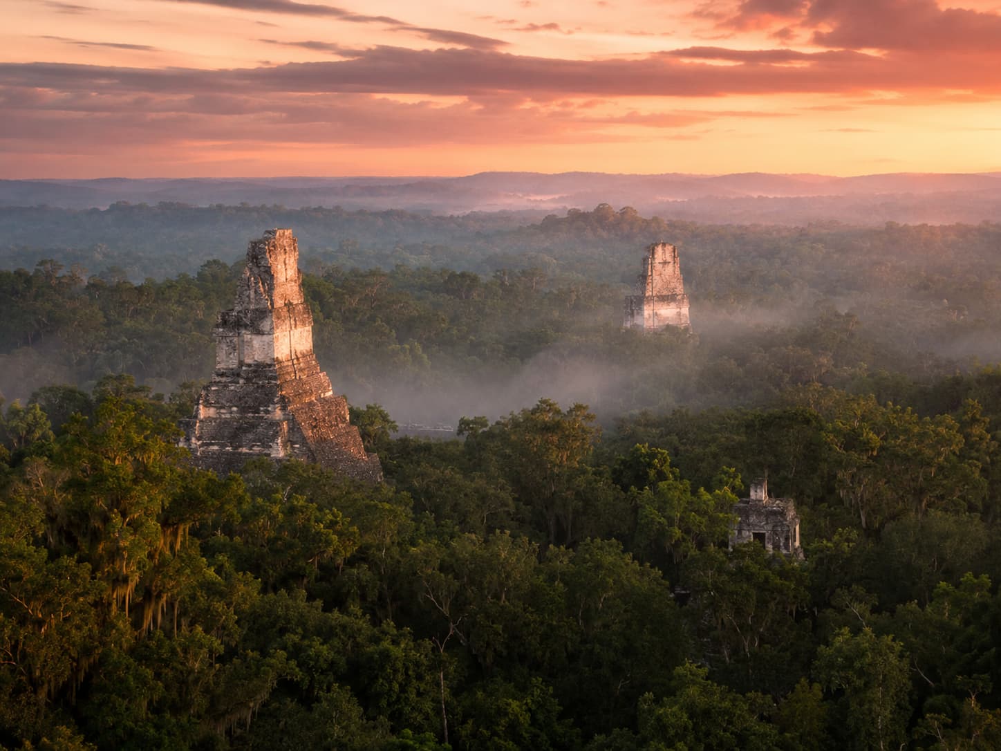
Tikal, in the Petén rainforest of northern Guatemala, was one of the largest cities of the ancient Maya world. At its peak, roughly 600 to 900 CE, it housed somewhere between 60,000 and 100,000 people in a tropical forest environment with no permanent rivers, no fossil fuels, no external energy supply, and no margin for error in the management of water, soil, and forest resources. The fact that it sustained that population for centuries is not an accident of geography. It is the record of an engineered solution to the problem of living within ecological limits. For anyone who thinks seriously about energy and sustainability, that record is worth examining in person.
Here are eight reasons to make the trip.
1. Tikal Was a Pre-Industrial City That Ran Entirely on Renewable Resources
Every calorie consumed at Tikal, every building raised, every object manufactured, every ceremonial fire lit was powered by solar energy in one form or another: food grown by photosynthesis, timber from forest ecosystems sustained by sunlight, human labour fed by that food. There were no other inputs. The city was a closed-loop system operating within a fixed energy budget determined by what the sun delivered to the surrounding rainforest each year.
This is not a metaphor. It is a literal description of the energy accounting that governed every aspect of Tikal’s economy. The hydraulic engineers who designed the city’s reservoir system were solving the same fundamental problem that modern grid designers face: how to store energy captured intermittently, deliver it reliably to a large population, and manage the system without catastrophic failure. They used water as the storage medium and gravity as the delivery mechanism. The scale was different. The underlying problem was not.
2. The Hydraulic Engineering Is a Masterclass in Water-as-Energy-Storage
Tikal sits on a limestone ridge with no permanent surface water within practical reach. The city’s survival depended entirely on capturing, storing, and distributing seasonal rainfall. The Maya engineers solved this with a system of reservoirs, canals, and catchment surfaces that has no parallel in the pre-Columbian Americas for its sophistication and scale.
The central acropolis plazas were deliberately paved and sloped to channel rainwater into a network of reservoirs, the largest of which could hold several hundred million litres. The reservoir walls were plastered with a lime-based sealant that prevented seepage. Sedimentation basins upstream of the main storage filtered particulate matter before it reached the drinking supply. This is engineering that would be recognisable to a modern civil hydrologist: the same principles of catchment design, storage sizing, and water quality management that underpin contemporary water infrastructure projects in water-stressed regions.
3. The Forest Management System Sustained Productivity for Centuries
The Petén rainforest is not a naturally productive agricultural environment. The soils are thin, the rainfall is seasonal, and clearing forest for cultivation tends to produce rapid soil degradation. The Maya of Tikal managed this constraint through a complex system of milpa agriculture, agroforestry, and managed forest reserves that maintained soil fertility, regulated water retention, and sustained the timber and botanical resources that the city required.
Recent LiDAR survey work across the Maya lowlands has revealed the full extent of this managed landscape: terraced hillsides, raised field systems in seasonal wetlands, canal networks for drainage and irrigation, and what appears to be a deliberate patchwork of forest in different stages of succession maintained across the wider landscape. This is not primitive slash-and-burn agriculture. It is a sophisticated landscape management system that kept a large urban population fed without permanently degrading the resource base, for several centuries. That achievement is more relevant to the current renewable energy and sustainable land use conversation than most textbooks acknowledge.
4. The Architecture Demonstrates Passive Climate Control at Urban Scale
The great temple pyramids of Tikal were not only ceremonial structures. Their orientation, massing, and surface characteristics reflect an understanding of solar geometry, thermal mass, and airflow that produced buildings capable of remaining significantly cooler than the surrounding environment during the hottest parts of the day. The broad plazas between structures channelled prevailing winds. The thick limestone walls absorbed heat slowly and released it at night. The elevated temple platforms caught breezes that did not reach ground level.
None of this was accidental. The Maya architects were working with the same passive solar and natural ventilation principles that modern green building design is rediscovering and formalising into certification standards. The difference is that the Maya had no alternative: active cooling was not an option, so the buildings had to do the work themselves. The constraints produced solutions that the modern built environment, with its easy access to mechanical cooling, has largely abandoned and is now trying to reconstruct.
5. The Collapse of Tikal Is a Direct Lesson in the Consequences of Exceeding Ecological Limits
Tikal’s decline, which accelerated through the 9th century CE, was not caused by a single catastrophic event. The current archaeological consensus points to a combination of prolonged drought, soil degradation from agricultural intensification, deforestation around the city’s perimeter, and the resulting collapse of the hydraulic system that the population depended on for water. When the reservoirs could no longer be filled reliably, the city became uninhabitable.
This is not a story about a primitive civilisation making avoidable mistakes. It is a story about a sophisticated society that pushed its resource management system to its operational limits over several centuries and eventually exceeded them. The parallels to current debates about planetary boundaries, resource overshoot, and the risks of fossil fuel dependency are direct and uncomfortable. As we explore in our discussion of the prospects of renewable energy, the transition away from finite resources is not optional in the long run. Tikal demonstrates what happens when that transition is delayed past the point of system resilience.
6. The Jungle Setting Makes the Sustainability Lesson Physical
Most of the great ruins of the ancient world sit in landscapes that have been transformed beyond recognition since their period of occupation. Tikal is different. The Petén rainforest that surrounds it is still largely intact, protected within a UNESCO World Heritage biosphere reserve that covers nearly 16,000 square kilometres. Arriving at Tikal by road through unbroken forest, watching the howler monkeys cross between the canopy and the temple platforms, hearing the birds that the ancient Maya would also have heard: these experiences make the ecological context of the city legible in a way that a museum display cannot.
You are standing inside the resource base. The trees around you are the same species that provided timber, food, medicine, and soil stability to the city. The water that fell last night is moving through the same drainage systems, in altered form, that the Maya engineers designed. The spatial relationship between the urban core and the surrounding ecological system that sustained it is still visible because the forest is still there. This kind of direct, physical understanding of the relationship between a human settlement and its resource environment is exactly what the sustainable energy field is trying to build into modern infrastructure planning, and Tikal provides it without any mediation.
7. Guided Tours Provide the Technical Context That Makes the Engineering Visible
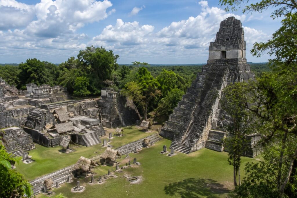
Tikal’s archaeological site covers 576 square kilometres, though the area accessible to visitors is concentrated around the central acropolis and the major temple groups. Without guidance, the visible structures read as impressive ruins. With a guide who understands the engineering, the hydraulic infrastructure, the agricultural systems, and the astronomical alignments, the same structures become a technical record of how a large city was designed to function within specific ecological and energy constraints.
Operators like Tikal Tours offer guided experiences that cover not only the archaeological highlights but the broader context of how Tikal worked as a city: the water management system, the agricultural hinterland, the trade networks that moved obsidian, jade, and cacao across the Maya world, and the astronomical knowledge embedded in the orientation of the major structures. For visitors from the renewable energy and sustainability sector, this contextual depth transforms the site from a historical curiosity into a case study in long-term resource governance.
8. The Surrounding Petén Biosphere Is a Living Laboratory for Biodiversity and Climate Monitoring
The Maya Biosphere Reserve, which contains Tikal National Park, is one of the largest protected tropical forest areas in Central America and one of the most intensively monitored ecosystems on the continent. Research programs operating within the reserve cover carbon sequestration rates, biodiversity indices, forest canopy dynamics, and the relationship between forest cover and regional rainfall patterns. The data generated here feeds directly into the climate models that inform energy transition planning at the regional and global level.
Satellite and AI-based monitoring of the kind discussed in our piece on AI and satellite data for biodiversity monitoring is being applied in forest environments like the Petén to track deforestation, measure above-ground carbon stocks, and identify illegal clearing within the reserve boundaries. Visiting the forest and understanding it as a physical system makes the satellite data more legible. The numbers on a screen represent trees, soils, water cycles, and carbon fluxes that are visible and tangible when you are standing inside them. That combination of field experience and remote sensing capacity is how the best environmental science gets done.
A Final Thought
The renewable energy transition is fundamentally a project of redesigning human civilisation to operate within the limits of what the sun delivers to the earth each year, without drawing down finite capital accumulated over geological time. That is a large undertaking with no guaranteed outcome.
Tikal is a record of a civilisation that attempted something similar, largely succeeded for several centuries, and ultimately failed when the margin between population demand and ecological supply closed too far and too fast. The ruins are not a warning about the futility of the attempt. They are a record of what the attempt looks like when it is taken seriously, and what it costs when it isn’t taken seriously enough.
That record is worth reading on site, in the forest, with the howler monkeys overhead and the temple platforms rising above the canopy. It puts the current conversation in a different kind of perspective.